Heavy metal contamination (including lead) has been found in Blue Hole Creek, Forbes State Forest, Somerset County, Pennsylvania
Blue Hole Creek originates from the top of Laurel Ridge near Seven Springs Resort. This headwater stream is classified as an Exceptional Value (EV) waterway, a designation reserved for streams that have the best water quality and abundant stream life. The EV designation also grants this waterway the highest level of protection from development and pollution loads from permitted sites.
From its origin point, Blue Hole Creek tumbles down a steep slope, crossing the Laurel Highlands Hiking Trail and eventually flowing under a well-traveled gravel road in Forbes State Forest, popular with cyclists, anglers, and snowmobile riders in the winter.

Below its confluence with Garys Run, Blue Hole Creek flows into a deep, blue hole that’s a busy swimming spot in the summertime. On a hot summer day, families and friends line up to take a dip in the cool, clear water. Our staff at Mountain Watershed Association often meet at this spot (even in the winter!) for a bracing polar plunge.
Finally, Blue Hole Creek joins Cole Run and Fall Creek, which all flow into the Laurel Hill Creek, a well-known trout stream popular with local anglers and tourists alike.
Recent Problems at Blue Hole Creek
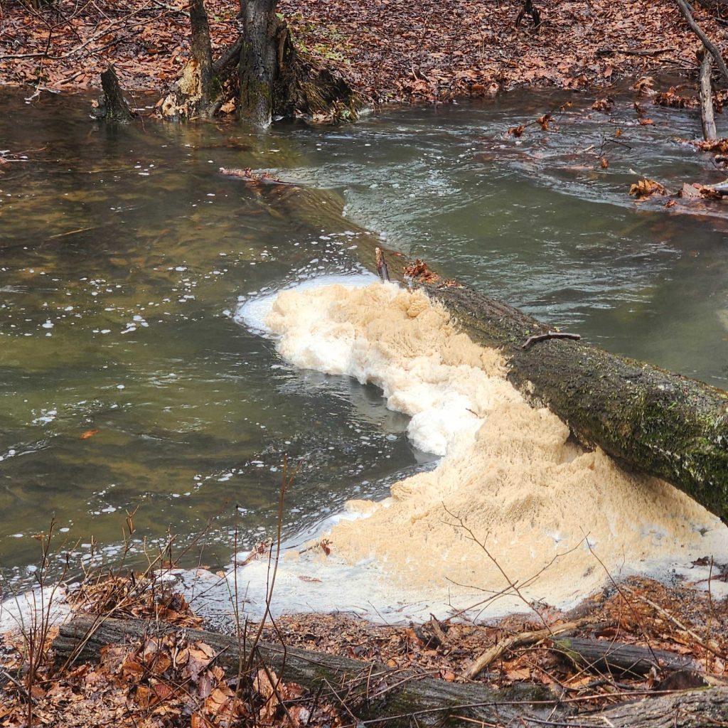
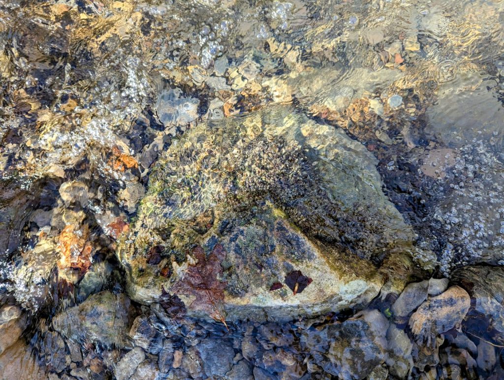
Recently, we’ve noticed something off in Blue Hole Creek. In 2024, our biological index sampling efforts failed to collect enough macroinvertebrates (aquatic bugs) to properly rate the stream’s health. More recently, the rocks poking out of the water were oddly pale, and the moss on those rocks had turned black. In a few areas, we noticed unusual foam building up.

We contacted staff from the Pennsylvania (PA) Department of Conservation of Natural Resources (DCNR) to check in about the situation. They informed us that recent water quality monitoring indicated high lead concentrations. Turns out, the PA Department of Environmental Protection (DEP) has been aware of this issue for over a year! We filed a complaint with DEP and received a response indicating that DEP’s Solid Waste Dept had responded to the issue.
MWA’s testing

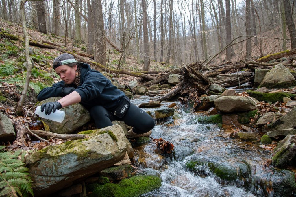
In the past couple of weeks, MWA has collected water samples to test for Aluminum, Lead, Iron, and other chemical and physical parameters at several locations. Our results indicate that the highest concentrations of lead were found near the Laurel Highlands Hiking Trail (LHHT).
This is very concerning due to the proximity of the Grindle Ridge Shelter Area, where many hikers will spend the night. The water pumps at the shelter areas are known to have high Iron concentrations, so hikers often use portable water filters at nearby streams for drinking water. Blue Hole Creek is one of the closest permanent water sources to the Grindle Ridge Shelters. Other hikers and several of our staff members have used this source while recreating on the LHHT in the last couple years.
Per Penn State Extention’s website on drinking water: “There is no safe level of lead exposure. EPA has set the Maximum Contaminant Level Goal (the level at which there are no negative health effects) at 0 µg/L for lead.”
Our results:
Blue Hole Creek near the Laurel Highlands Hiking Trail: This sampling location was just downstream of where the LHHT crosses Blue Hole Creek. Our results, which were analyzed by a certified and state accredited lab, came back with 370 ug/l (micrograms per liter) or 370 parts per billion (ppb). We were shocked to find such high concentrations in one of our area’s most beloved waterways. Aluminum concentrations were also very high at 7 mg/l.
For context, the majority of water samples collected in Flint, MI had concentrations of 12 ug/l or ppb. The concentration of lead in Blue Hole Creek near the LHHT was more than 30 times as bad as the water in Flint.
Blue Hole Creek swimming hole: Sampling results from the popular Blue Hole Creek swimming hole, located just downstream of the convergence of Garys Run and Blue Hole Creek, came back with 10.8 ug/l for lead. (Correction: a previous version of this post showed the decimal point in the wrong place – 10.8 ug/l is the correct data)
Grindle Ridge Pump: We also sampled at the Grindle Ridge Pump. Results indicated that lead concentrations were 1 ug/l, or 1 ppb. Any concentration of lead in drinking water is considered unsafe to drink and can be harmful to human health. Therefore, the Grindle Ridge Pump will likely be shut down until sampling shows it is safe to drink/use.
We have also collected water samples from the tributary to Garys Run, just west of the Grindle Ridge Shelter Area along the LHHT, and will provide an update when the results are received.
Please spread the word! Drinking water from Blue Hole Creek near the LHHT is most certainly harmful to your health. We cannot advise drinking from Grindle Ridge Pump, as concentrations of lead exceed the recommended concentrations for safe drinking water.
Can I still fish in the creek?

Consuming fish from streams contaminated with lead is not advisable. Blue Hole Creek, which is a stocked trout fishery, may or may not have fish that have been negatively impacted by the presence of lead. Please use this information to make your own educated decision.
What are the next steps?
We are investigating the origin of the lead and will be doing everything possible to hold the polluter accountable for the introduction of pollution into our waterways.
DCNR has posted signs where the Laurel Highlands Hiking Trail crosses Blue Hole Creek, warning hikers not to drink or use the water. The State Forest also plans to add a sign at the swimming hole, urging swimmers to use caution.
For more information, please contact our Youghiogheny Riverkeeper, eric@mtwatershed.com
Updates below!
- Sampling data from June 2025
- PA DEP issues Notice of Violation to Highland Sporting Clays