After MWA discovered significant lead pollution in Blue Hole Creek, there was a huge community reaction. Rightly so – Exceptional Value headwater streams are incredibly important to the watershed as a whole, including many sensitive private water supplies. Here’s an update on the issue, answers to questions we’ve heard, and steps you can take to test your own water.
Many folks have expressed frustration that this issue has taken so long to resolve. Unfortunately, communication between state agencies is not always a straightforward process.
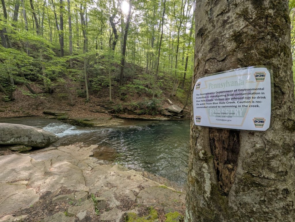
After our initial testing and communication with PA DCNR, we felt it was necessary to post signs at the swimming hole, on the Laurel Highlands Hiking Trail, and at the Grindle Ridge Shelter Area. Those signs were posted quickly, but it took much longer to get water quality results from PA DEP. Further, DEP wasn’t aware that hikers were using the creek for drinking water, and the agency doesn’t recommend drinking surface water for any reason.
In the meantime, MWA established several monitoring points to better understand water quality in Blue Hole Creek and determine if there was any impact to the receiving stream, Fall Creek. At minimum, we sample six different locations in the area.
We’ve discovered that lead concentrations are lower the farther you travel downstream. Highest lead concentrations occurred at a sampling location near the Laurel Highlands Hiking Trail, where lead concentrations range from 299 – 371 micrograms per liter (ug/l). In headwater streams, there should be zero detectable levels of lead.
As the water flows downstream, the lead concentrations eventually drop to nearly zero. The popular “Blue Hole” swimming area has concentrations that have ranged from 11 – 16 ug/l.
We’ve received a lot of questions about where this contamination could be coming from, so here’s a quick rundown of answers.
- Is it from mining, fracking, an abandoned landfill, or natural causes? We do not think any of these issues are the source of lead in the headwaters or at the creek. Our team regularly tracks current and past permitting throughout the watershed and has strong general knowledge of activity particularly in these sensitive areas. Further, based on 2025 water quality monitoring results from the PA DEP Division of Water Quality (DEP DWQ) posted on their EMap online mapping resource, lead levels were documented at 302 ug/l. The DWQ determined a source as Recreation and Tourism (Non-Boating). The screenshot below shows the EMap website view of Blue Hole Creek.

Why are concentrations so much lower downstream? Dilution and oxidation contribute to the lower concentration. The small tributaries that flow into Blue Hole Creek increase water volume which may dilute the concentration of lead in the water.
Lead is typically not water soluble. However, lead is highly soluble in acidic water with a pH of 4.0 (similar to the reading we measured near the top of the stream) and easily dissolves. Additionally, the effect of a babbling brook creates oxidation of the water as it rushes over rocks, bringing the pH of the creek back to a more neutral state (pH of 7 is neutral).
Where does the lead end up as the water travels downstream? As the pH increases, lead will no longer be dissolved. It becomes solid and falls to the bottom of the creek settling into sediment and the creekbed.
How can the stream go back to its original condition and live up to its Exceptional Value designation? First, the source of the issues needs to be remediated. However, it’s hard to account for the amount of lead in the streambed and on the banks. It will likely never be completely removed from the stream.
Is the Blue Hole Spring safe to use? We collected samples at the Blue Hole Spring, a common drinking water source for many people in the area. So far our samples have not had any detectable concentrations of lead in Blue Hole Spring. Our assumption is that the Blue Hole Spring groundwater source is at a lower, non impacted level and therefore not impacted by the contamination.
However, we do want to advise those who use it to use caution. Our sampling is only a snapshot of water quality – we only know concentrations at the exact moment we take a sample. Furthermore, our sampling does not include all harmful constituents that could be present.
Again, DEP doesn’t recommend using roadside springs or surface water due to the potential presence of pathogens and harmful contaminants. Consume at your own risk.
MWA is still working with PA DEP, PA DCNR, and EPA to resolve this issue. As soon as we have further action on the matter, we’ll update the public!
If you’re worried about heavy metals in your drinking water (especially if you have a well), check out our instructional video on how to safely collect a sample and properly transport it to a geochemical lab.
(Bottles can be ordered from Geochemical Resources in Somerset – check out their website for more information.)
As always, if you see something or suspect a pollution issue in our watershed please report to our team at (724) 455-4200 or admin@mtwatershed.com and file a complaint directly with the Pennsylvania Department of Environmental Protection at this Complaint Form.
Update!
PA DEP issues Notice of Violation to Highland Sporting Clays